
Ricks Spring
Abstract
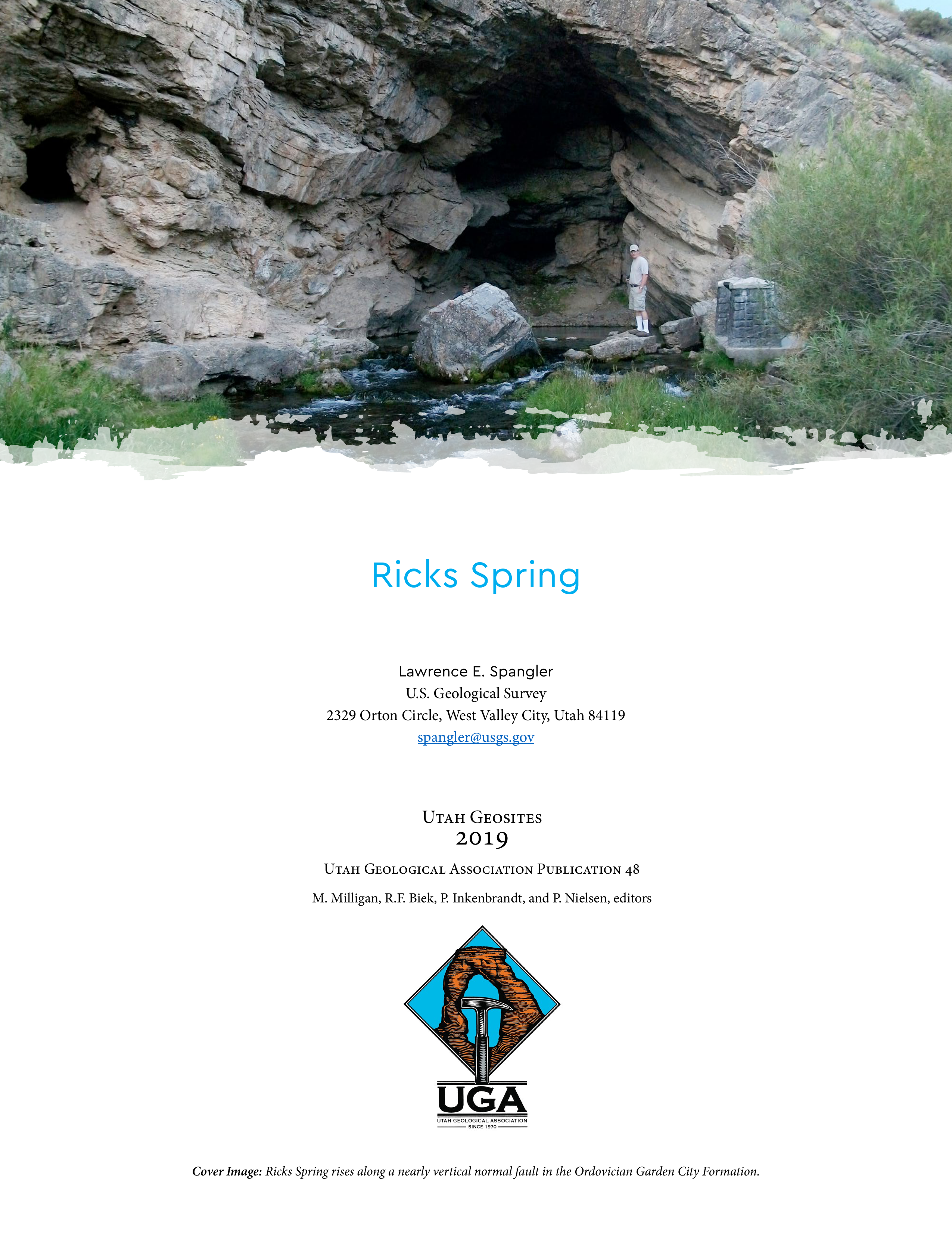
Ricks Spring is one of several major karst springs that discharge along the Logan River in the Bear River Range in Cache County, Utah. The spring is located along U.S. Highway 89 in Logan Canyon about 17 miles (27.4 kilometers) northeast of (up-canyon from) the city of Logan, at mile marker 477. It lies within Uinta-Wasatch-Cache National Forest at an elevation of 5880 feet (1792 meters). Situated at the base of a hillside, the spring is one of the largest and most scenic along the Logan River (figure 1). Water from the spring flows out of a large alcove, under Highway 89, and into the Logan River, about 150 feet (45 meters) from the spring. Pullouts on both sides of the highway provide parking for visitors to the spring, and a boardwalk crosses the spring run, which allows access to the rise pool in the alcove. Several signs at the spring provide information about its history and hydrology. Ricks Spring typically flows during the spring, summer, and fall months, but can have periods of no flow during the winter months, particularly during extended periods of cold weather. During these times, the water in the rise pit recedes to a small pool of standing water that can contain fish, which presumably originate from the nearby Logan River. During the last 10 years, cave divers have explored the conduit that feeds the spring for about 2300 feet (700 meters) into the mountainside.
Copyright (c) 2019 Utah Geological Association

This work is licensed under a Creative Commons Attribution 4.0 International License.
