
Paradise from Cataclysm: Zion Canyon’s Sentinel Landslide
Abstract
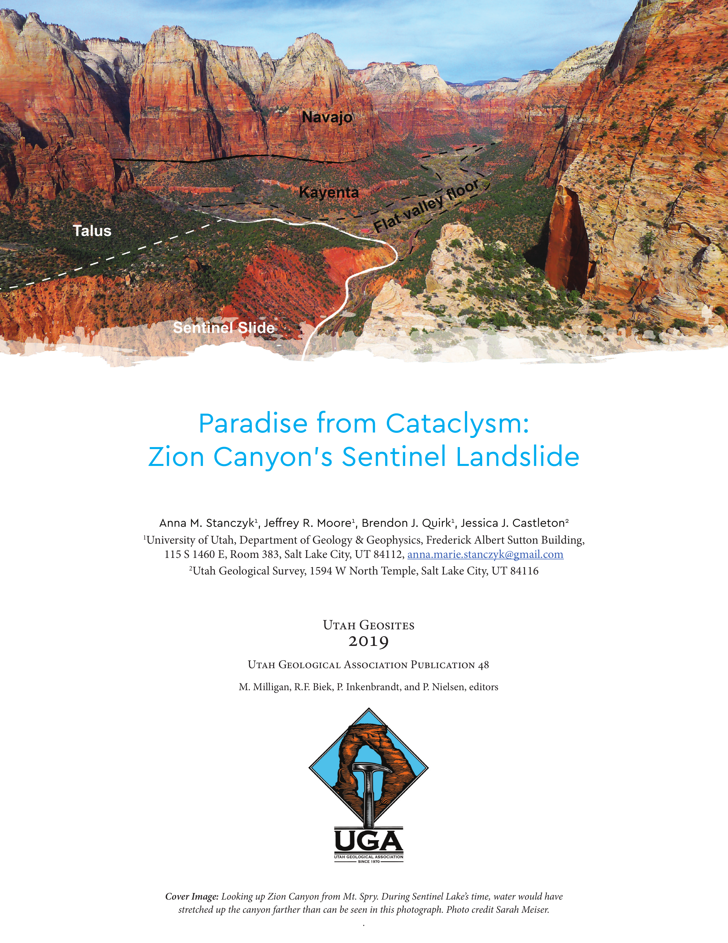
Zion Canyon hosts millions of visitors each year, yet few are aware of the massive prehistoric landslide that played an important role in shaping the iconic landscape. South of the Sand Bench trailhead and bridge, a large hill encroaches on the canyon bottom around which the North Fork Virgin River flows. North of the bridge, Zion Canyon’s fl at bottom stretches into the distance. The hill is part of an enormous rock avalanche deposit known as the Sentinel slide that is nearly 2 miles (3.2 km) long and more than 650 feet (200 m) thick. After failure, the Sentinel rock avalanche dammed the North Fork Virgin River creating a lake (known as Sentinel Lake) which persisted for approximately 700 years (Grater, 1945; Hamilton, 1976; Castleton and others, 2016). Over the course of the lake’s lifetime, sediment settled at the bottom of the lake to create thick deposits of mud, clay, and sand. Sediment eventually fi lled in the canyon bottom behind the landslide dam, and the lake ceased to exist. Th ese sediment layers are still visible today and are responsible for the remarkably fl at fl oor of upper Zion Canyon (Grater, 1945; Hamilton, 2014; Castleton and others, 2016).
Copyright (c) 2019 Utah Geological Association

This work is licensed under a Creative Commons Attribution 4.0 International License.
